A different approach to measuring density – part one
This summarises some developing ideas on strategic planning, in particular trying to find a more spatial way to think about density.
Fundamentally density is a way of linking people to space in a way that can be compared within and between cities. However it could be argued that there are a number of flaws in the widely adopted approach, measuring people per hectare, that impact on the way cities function.
Density is the measure of people per unit area of land based on the building/plot/urban block.
If data on occupancy exists, the total number of people per building/plot/block can be summed and divided by area of land occupied. This is mathematically accurate but limited to areas where data is held. It is unusual for this data to be held across an entire city.
Where the data doesn’t exist it can be synthesised; estimate gross floor area of buildings (measure building footprint* from satellite imagery and multiply by height* identified through ground level imagery), apply assumptions on land use* (based again on interpreting imagery or on land uses assigned in planning policy*), take up* and space per person*. This leads to population per building/plot/block. To extend up to the city area apply net to gross* assumptions on area taken up by public spaces and roads.
It’s easy to calculate density at the level of the city or masterplan, albeit within a wide tolerance (the asterisks indicate at least seven assumptions).
It’s also intuitively easy to understand and manipulate for design and planning.
The point of this is not to criticise the accuracy of data, which is very difficult to get away from, the point is to re-think density in relation to how cities work.
Some comments on measuring density are as follows:
Boundaries
Cities have a wide range of densities within them. Providing an average density at the city scale gives an indication of something, but it is often required at a smaller scale, for example the city centre, a neighbourhood etc.
To calculate these densities requires the definition of a boundary.
Where cities are divided by clear spatial boundaries, such as rivers, hills etc., this can be done easily. Where it is more difficult is when a city is a continuous network of space (e.g. Manhattan).
Where there are no clear spatial features to follow, the boundary to calculate density becomes arbitrary. Where the boundary is placed will have a major impact on the result of the calculation.
A virtual line drawn on a plan may have nothing to do with how conditions on the ground vary.
Measuring density in this way is easy where land has been sub-divided or parcelled. Because density is easy to assign to parcels when planning, it could be argued that it is a major contributor to the phenomenon of inward looking, isolated development. Cities that follow these patterns of development are often segregated and rely on personal vehicular transport.
Block-based development
This understanding of density is based on a measure of the block. The block is a physical definition of the private parts of a city rather than the public parts.
When blocks are developed individually they can easily be understood in isolation from their wider context. At the scale that might occur in a city centre, it’s not unusual for a building to be placed at the centre, surrounded by car park, and accessed from a single point. Often there is no relationship with the plot’s neighbours. On the edge of a city, these developments might be large, low density, cul-de-sac type sub-divisions accessed from a single point.
Both of these examples internalise and isolate any activity from the wider city. They provide no benefit to the city (animation, natural surveillance, ownership), nor receive any benefit (passing trade, social integration).
In fact it could be argued that not only do they not contribute positively, they actually make cities worse. As an example, a four sided block may have one entrance to it. The remaining three sides do not feed people in to the network of the city (on foot or by car), and so any passing traffic does not need to slow down. Because traffic doesn’t need to slow, it becomes a road rather than a street. The road creates a negative character and so development turns its back on it. This reduces natural surveillance, and also means there is no presence of people on the street, and no need to slow down.
Character
When planned using blocks, land use, density and massing are all distributed evenly across the block as a whole.
In cities that grow over time, urban blocks do not have characteristics defined so consistently. The blocks are the result of a street network that connects strategic places together, but also distributes movement in a way that naturally creates quiet places.
As a consequence of this the land use, density and massing tend to be consistent along each edge of a block, but different across the block itself.
This more subtle understanding of the interface between the public and private helps reduce the number of places where streets have no one in them and/or are defined by blank frontages.
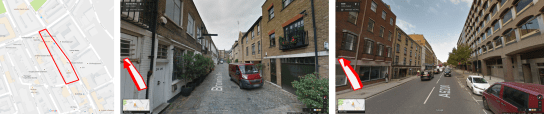
Above – land use, density and massing change on each edge of the same urban block creating active frontage.
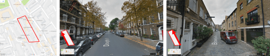
Above – land use, density and massing are consistent across the block resulting in blank frontage and under-used areas.
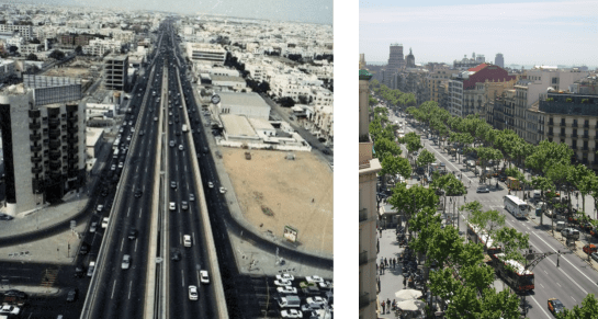
Car-based or Street-based urbanism
A block level understanding of density dovetails with a focus on car-based urbanism, and contributes to many of the negative outcomes associated with this.
The antidote to this is Street-based urbanism. This is a short-hand description for places where it is possible to mix people moving on foot, by bike, car and public transport. Where what is happening inside the private urban block (or building) contributes to and engages with activity in the street. This happens through the location of entrances, active frontage, overlooking windows, and (sometimes stacking) mixed uses.
At the smaller scale, this type of urbanism is generated through masterplanning and design guidelines, however because the planning framework uses a block based understanding of density, translating block level allowances in to street based urbanism is not always straight forward.
Over-simplification
While it is fair to aggregate or simplify data for a particular purpose, the risk of this process is that the simplified data is used inappropriately at the wrong scale.
This often happens with density allocations, where a simplified block level allowance can be easily applied consistently across a plot, rather than distributed across it in relation to its context.
The over simplification of population data makes it complicated to unpack in a way that can create Street-based urbanism, and it is argued that a different approach to using density is needed to overcome this.
Alternative measures of density
Building Centred Density offers a finer scale description of density. It takes each building/plot, and calculates the population within an isochrone radius that relates to an area of one hectare.
The benefit of this approach is that the iscohrone is calculated by moving through the network, meaning that the description of density is closer to the way it is experienced on the ground.
This understanding is helpful but more suited to use at the small scale or later during the more detailed stages of design. It is also data hungry.
People per segment
The alternative is to think about density in a different way. Fundamentally, density is link between people and space. By using density instead of population it allows comparison between cities, or parts of a city to be made.
If one of the reasons for using density is to link people to space, a measure of people per street segment (a segment is the single space between intersections) could be used instead. Population or employment can then be distributed per street, and normalised using people per linear metre of street.
If allocated to the segment, population can then be aggregated up to the block if necessary, or to the entire city. At the scales between this, it can be aggregated based on a specific radius (or many radii) of isochrone.
One benefit of this is that it is a network based measure of density. It creates many unique, overlapping areas of density which are more representative of the way that the characteristics of a city change.
If the number of people per street segment are defined, it also makes it possible for the average distance to other plots to be understood in way that is not possible using block based densities. Whilst there are a large number of assumptions/complexities to do this accurately, it begins to describe how walkable an area is.
At a conceptual level, this approach links people to the activity within a street rather than separating them from it. This may help to cross the siloes of city making discipline that have contributed to the fragmented cities that have emerged in the past 50 years.
Another aspect to this approach is that it allows strategic planning to become more flexible. Rather than planning being an exercise in accommodating a single land use scenario (based on an economic and demographic forecast) it makes it possible for many land use scenarios (that may change over time) to deliver the activity in a city as an outcome. This allows a plan to be flexible, changing over time if a particular land use becomes more suitable in future.
This is an early idea, it also needs a suitably flexible approaches to energy supply/distribution, land ownership, governance/administration and financing to be integrated. The design of individual buildings also needs to be coded to respond to, and address, its plot edges to create street-based urbanism.
Creating street based population measures needs some more advanced spatial analysis than creating block based measures, but it is by no means difficult. It still needs the same assumptions on population and employment to be made at a certain point, but the key to this approach is in the way these numbers are distributed across the edges of blocks rather than inside them, and that this is consistent with the way that cities have grown and developed over many centuries. The point of this is not to say that we shouldnt plan cities, or that we should plan them in a way that makes pastiches of historic parts of cities, but that the processes that lead to their formation are understood and can be applied in a planned way.
This approach needs some visualisation which will be added here soon.

Pingback: Learning from informality | D.A.S.