Archive

Space Syntax

City_x

This is an extract from a positioning paper I recently co-authored for Space Syntax around the future of the city. This post is an extract of the longer-term risks and opportunities.

The paper set out short- and long-term issues facing society, and suggested opportunities for technology to help address them.

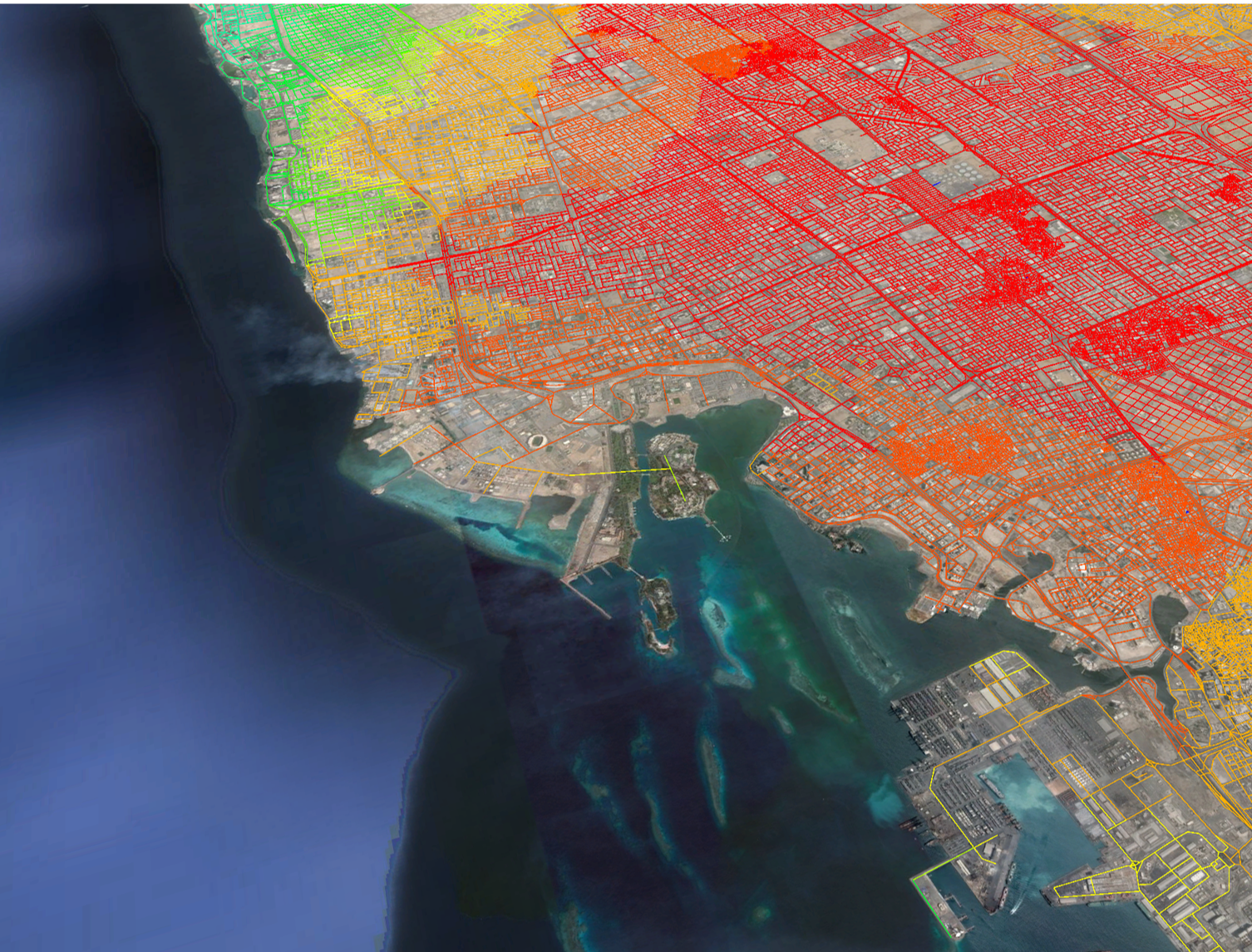
Existing and emerging technologies provide potential solutions, but these need to be developed carefully to deliver a vision that everyone supports. Without going through this process and agreeing a social contract to operate them within, the risks have been widely publicised: a surveillance state, loss of privacy, loss of control and lives being ruled by multi-national tech giants.

This post sketches out a positive future supported by technology, where, in an older, post-work society, the city as an organisation plays a different role. In this future, tech provides a platform to stimulate local economic activity, provide access to services, develop new models of housing, protect privacy, and by integrating all of these, to attempt to address inequality.

Read More

007

This is the summary of a talk I gave recently at a Mob Ox event in Oxford. It picks up some of the ideas in this post about Uber, and is especially relevant in relation to Waymo’s recent announcement.

It focusses on some work we’ve been doing to understand how infrastructure and land use interact in cities, and uses this to frame the conversation around these mobility services

Read More

Centrelines

These are some notes from a talk I gave at Space Syntax’s last Urban Imperative: Improve, Extend, Create series of events in July. It looks at how to think about designing a city from scratch. The focus of this post is to look at exactly which components of a masterplan to design and why.

This shows some work that is slightly experimental. At the moment it’s about testing ideas through a process, and at the moment it’s only a process. It started as a real project to look at ideas about how to develop a city from scratch but then some further research work was done.

Read More

This is a research paper I recently presented at the 11th Space Syntax Symposium in Lisbon, co-authored with Stephen Law and Laurens Versluis.

The paper has been reformatted for re-production here and the original published version can be found here .


Abstract

This paper describes an exploratory methodology used to study the national scale issues of population growth and infrastructure implementation across the UK. The project was carried out for the Government Office for Science in 2015, focussing on two key questions: how could a “spatially driven” scenario provoke new thinking on accommodating forecast growth, and; what would be the impact of transport infrastructure investments within this context.

Addressing these questions required the construction of a national scale spatial model that also needed to integrate datasets on population and employment. Models were analysed and profiled initially to identify existing relationships between the distribution of population and employment against the spatial network. Based on these profiles, an experimental methodology was used to firstly identify cities with the potential to accommodate growth, then secondly to allocate additional population proportionally. This raises important questions for discussion around which cities provide the benchmark for growth and why, as well as what the optimal spatial conditions for population growth may be, and how this growth should be accommodated locally.

Later the model was used to study the impact of High Speed Rail. As these proposed infrastructure changes improve service (capacity, frequency, journey time), rather than creating new topological connections, the model was adapted to be able to produce time based catchments as an output. These catchments could then be expressed in terms of the workforce population within an hour of every city (a potential travel to work area), as well as the number of employment opportunities within an hour of every household.

Read More

SSx_Digital_Transport_Exchange

These are the notes from the session I was part of at Friday’s Digital Transport Exchange.


How can we best collaborate to improve personal mobility?

There are two issues behind this question:

Firstly, that personal mobility isn’t as good as it should be. This is one of the big issues that’s raised a lot at the moment all around the world. Especially how the combined costs of mobility and housing is pushing people further out of cities and/or detrimentally affecting their daily lives.

This is not just an issue about how to provide mobility services, but it’s a wider issue around a planning and design.

Secondly, collaboration is not as good as it should be. This includes sophisticated disciplines working in parallel, differences between public and private sectors, short- and long-term decision makers, and divisions within large organisations. The result of this is that the outcomes of design, planning and service strategies optimise individual systems rather than creating combined outcomes that benefit the wider city.

By using urban analytics that are strategic in nature, precisely link people to space, and focus on outcomes not systems, we can start to address these issues.

Read More

photo

Notes from a Smart Cities panel I was part of at CREATech 2017

What is a Smart City?

Theres a one line answer which is probably very obvious: smart cities use data and technology to make cities better. The important part though is that they make cities better for people – that is happier, healthier and wealthier.

Read More

uk_model.png

This is the combination of a couple of talks I’ve given in the last few months to the ULI Urban Tech Committee and the Academy of Urbanism Digital Urbanism groups.

Urban Tech is something that has developed a lot in the last 10 years and which now seems to have a lot of interest and attention. There are a lot of terms – Future Cities, Smart Cities, Prop Tech, Urban Tech, etc – which are all slightly related but not quite connected in the way they could be.

One way of trying to understand how they fit together is by tracing what has changed in this time and what this means for the way we interact with cities.

While its interesting to see how things have changed, what is possibly more important, as professionals who work with, and in the context of cities, is to ask the more difficult “so what” questions of why things should change?

Here’s an outline of the reasons Why that will be explained in more detail below:

  • Better outcomes for cities and people
  • Creating benefits between public and private sectors in the short and long terms
  • More transparent and inclusive decision-making
  • Crossing siloes between planning and service delivery for more effective and efficient spending

Read More

Foresight_Obesity_Map.png

This post is a summary of a presentation I gave at the BRE Cities Regeneration Conference.

What does health mean?
At the moment there’s a lot of press attention on obesity, but health is much more complex including: communicable and non-communicable illness (Non-communicable  include Obesity, Diabetes, Cardio Vascular, Respiratory and Mental Illnesses), causation and correlation, “hard” and “soft” urban systems and complicated versus complex.

The key question for urban design and planning is: (How) does urban form impact on health outcomes?

Read More

This is a summary of a number of issues around Integrated Urban Modelling discussed in a panel session at the Future of Wireless International Conference 2015. This picks up on a number of issues raised by the Integrated Urban Modelling post but has more of a focus on data.

What are the implications for a fully connected world and how will this impact on the urban landscape?

The opportunity is to collect data at a scale, resolution and frequency that was previously impossible. This means it’s possible to see patterns of movement across an entire city across the whole day. The real question though is how best to use this, and what do we actually need to make cities better?

Read More

001

This is a summary of a number of issues around Integrated Urban Modelling presented and discussed in sessions at the BRE Cities ConventionModelling World 2015, the Future of Wireless International Conference and in the paper: “Integrated sub-regional planning informed by weighted spatial network models: the case of Jeddah Sub-regional system”, (co-authored with Dr Kayvan Karimi and Abhimanyu Acharya) and presented at the 10th Space Syntax Symposium. Presentations can be found on the relevant websites.

Read More